Aviation Weather with Decoder: Your All-in-One Aviation Weather Solution
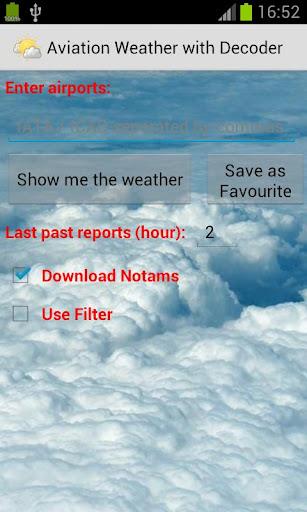
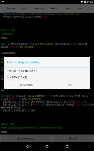
This comprehensive weather application delivers precise and current meteorological data, simplifying flight planning and enhancing situational awareness. Access multiple weather reports concurrently, enabling efficient pre-flight preparation. Review past weather reports to identify trends and patterns, improving your understanding of weather conditions.

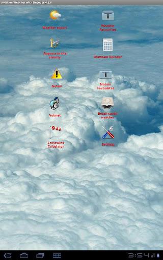
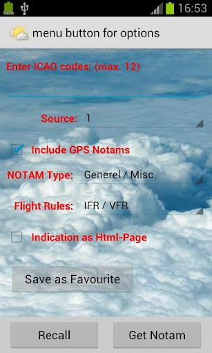
The app offers seamless storage of reports and NOTAMs, centralizing critical information. Easily input airports using ICAO/IATA codes or airport names, and instantly view them on Google Maps for intuitive location tracking. Personalize your experience by adjusting text color, size, and font. Helpful tools such as a METAR decoder, VOLMET access, and a crosswind calculator are also included.
Key Features:
- Simultaneous Multi-Location Weather Reports: Track weather conditions across multiple locations simultaneously.
- Historical Weather Data: Access past weather reports for insightful trend analysis.
- Centralized Report & NOTAM Storage: Conveniently save and retrieve essential flight information.
- Simplified Airport Input: Quickly access weather reports using ICAO/IATA codes or airport names.
- Google Maps Integration: Visualize airport locations directly on Google Maps.
- Customizable Interface: Tailor the app's appearance to your preferences for optimal readability.
In Conclusion:
Aviation Weather with Decoder provides a robust platform for accessing and interpreting METAR and TAF reports from NOAA. Its combination of multi-report viewing, historical data access, convenient storage, and customizable interface makes it an efficient and user-friendly tool. The Google Maps integration and inclusion of specialized aviation tools add significant value. Download today and make informed decisions based on accurate, readily available weather information.